Wednesday 25 September 2019

7 dni w Tybecie.


    Od zawsze Tybet był mistyczną krainą wzbudzającą zainteresowanie ludzi z zachodu i wschodu. Europejczyków ciekawiła kultura i życie na tym niedostępnym i trudnym terenie. Azjaci żądni byli zdobycia obszaru będącego strategicznym punktem pomiędzy Chinami a Indiami. Przez wiele lat tybetańska armia oraz niedostępność geograficzna skutecznie broniły dostepnu do swojego kraju. Co więcej, to właśnie Tybetanczycy zagarniali okoliczne tereny, przyłączając je do swojego imperium, które sięgało daleko wgłąb obecnych Chin na północy i na tereny dzisiejszego Bangladeszu na południu. Przez brak źródeł pisanych, ten okres historyczny jest nam bardzo mało znany i dzisiaj pozostają tylko domysły, jak wyglądało wtedy życie na Dachu Świata.
    W VII wieku Tybetańczycy postanowili zawrzeć pakt z Chinami przeciwko innemu zagrażającemu obu krajom królestwu. Jego przypieczętowaniem stało się małżeństwo pomiędzy tybetańskim władcą, a córką chińskiego cesarza, która powrzechnie uważana jest za odpowiedzialną sprowadzenia do Tybetu Buddzymu, który z biegiem lat w większości wyparł oryginalną dla Tybetu religię Bon.Transformacja z walecznego w pokojowy sakralny naród nastąpiła jednak dopiero kilka stuleci później, wzmocniona przez nawiązanie kontaktów z Imperium Mongoliskim. Stąd aż do dziś daje się zauważyć podobieństwo pomiędzy tymi dwiema nacjami. To z mongolskiego języka pochodzi słynny tytuł Dalaj, tłumaczony jako “ocean” (w znaczeniu nieograniczonej wiedzy).
    Do początków XX w Tybet był praktycznie nieznany Europejczykom. Pierwsi pojawili się tam misjonarze, a następnie delegacje Brytyjczyków reprezentujących Kompanię Wschodnioindyjską (dzisiejsze tereny Indii). Konflikt rozpoczął się w 1903 roku, gdzy Brytyjczyny zaczęli podejrzewać Tybetańczykow o kontakty z Impreium Rosyjskim, z którym ci pierwszi rywalizowali o wpływy w Azji. Liczne pakty zawarte pomiędzy spornymi stronami uchroniły od konfliktów zbrojnych oraz ostatecznie przyczyniły się do uznania przez Rosjan i Brytyjczyków zwierzchności Chin nad Tybetem.

    Pomimo, że niepodległość Tybetu nie była oficjalnie rozpoznawana na arenie międzynarodowej, po upadku ostatniej chińskiej dynastii Qing w 1913 roku, teren stał się niezależny. Tybetański rząd zaczął nawet produkcję własnych znaczków pocztowych.
Sytuacja społeczna w tym okresie, może dziś wzbudzać kontrowersje – panował bardzo silny system kastowy, z góry ustalający życie danej jednostki. Mieszkańcy często odciętych od świata wiosek żyli niemalże jak w Średniowieczu. Często brakowało jedzenia, warunki mieszkalne były bardzo prymitywne, brak opieki zdrowotnej był źródłem wysokiej śmiertelności kobiet w ciąży i noworodków. W tym samym czasie dostojnicy i przyboczni Dalaj Lamy, należący do kasty rządzącej, mieszkali w pozłacanych pokojach pałacu Potala i jedli najwykwintniejsze dania.
    Wszystko zmieniło się wraz z początkiem Chińskiej Republiki Ludowej, 1 października 1949 roku. Polityczny lider – Mao Zedong oraz jego ministrowie wprowadzili bezwzględne rządy  mające na celu przede wszystkim podporządkowanie się Partii oraz wprowadzenie całkowicie komunistycznego stylu życia. Oczywiście jakakolwiek odrębność kulturowo-polityczna nie była mile widziana. Rok później Chińska Armia Ludowo-Wyzwoleńcza wkroczyła na Wyżynę Tybetańską pod propagandowym hasłem “ochrony od imperialistycznego (tj. zachodniego) ucisku”. O ile do końca lat 50 przywódcy w Lasie – stolicy Tybetu, mieli jako taką autonomię, o tyle 1959 sytuacja stała się tak napięta, że polityczno – duchowy lider Tybetańczykow Dalaj Lama zdecydował się na ucieczkę z ojczystej ziemi i założenie rządu na uchodźstwie w indyjskim miasteczku – Daramshala.
    Dziś można dwojako postrzegać “przyłączenie” Tybetu do Chin i narzucone przez komunistów zmiany. Z jednej strony to oczywiste pozbawienie niepodległości lokalnej społeczności i ograniczenie ich praw; często też próba wykorzenienia kultury i religii, zniszczenie ogromnej ilości zabytków i historycznych zbiorów. Z drugiej strony, nie można pomijać faktu, że ingerencja Chińczyków przyczyniła się do znacznej poprawy sytuacji materialnej Tybetanczykow. Zniesiono system kastowy, wprowadzono obowiązek nauki w szkole (wcześniej większość ludzi była niepiśmienna), poprawiono warunki sanitarne (np. śmiertelność noworodków  zmniejszyła się z 45% w 1959 do 0.3% obecnie). 

    Wraz z otwieraniem się Chin na świat pod koniec lat 70, Tybet stał się dostępny dla zachodnich podróżników oraz himalaistów. Być może koniem napędowym stała się między innymi książka Heinrich’a Harrer’a “Siedem lat w Tybiecie” oraz film pod tym samym tytułem, które ukazują Tybet jaką romantyczną krainę z przepięknymi widokami i intrygującymi ludźmi. Kolorowe stroje, tradycyjna zabudowa, tajemnicze obrzędy, zapierające dech w piersiach widoki wyżyn i gór. Nic dziwnego, że Tybet stał się marzeniem wielu backpackerow, hippisów, poszukiwaczy przygód i zdobywców najwyższych szczytów świata.
    Możliwość eksploracji Wyżyny Tybetańskiej, podpartywania życia lokalnych ludzi oraz obcowania z jedyną w swoim rodzaju naturą, zostały nagle znacznie ograniczone. Z powodu narastającego napięcia politycznego, licznych protestów Tybetańczykow i coraz częściej dających o sobie znać organizacji walki o niepodległość, w 2008 komunistyczny rząd chiński ograniczył wjazd do utworzonej w 1965 roku Autonomi Tybetańskiej dla obcokrajowców oraz samych Tybetańczykow mieszkających poza tym obszarem.
    Od tego czasu, aż do dziś dla wszystkich nieposiadających chińskiego dowodu osobistego jedyną opcją odwiedzenia Tybetu jest zapisanie się na zorganizowaną przez oficjalne biuro podróży wycieczkę z przewodnikiem i kierowcą. “Grupę” może stanowić nawet jedna osoba, ale przeważnie dla zmiejszenia kosztów – które nie należą do najmniejszych – turyści tworzą kilku lub kilkunastoosobowe ekipy. Bogate oferty bardzo licznych agencji i biur podróży są dostosowane do praktycznie każdych wymagań gości. Od weekendowych do kilku tygodnowych wypraw. Zwiedzanie tylko stolicy, lub objazdowy “tour” po mniej popularnych częściach Tybetu i możliwość zobaczenia najwyższej góry świata – Mount Everestu, zwanego tutaj Czomolungma (którego szczyt przebiega dokładnie pomiędzy Nepalem z Chinami).

    Dla niezależnych podróżników, taki wyjazd może wydawać się nudny i schematyczny, jednak nawet na dość ograniczonym polu manewru da się sprawić, aby pozornie szablonowy wyjazd różnił się od pozostałych. Tym razem kluczem nie jest wyjazd “off the beaten track” (w miejsca nie będące popularnymi turystycznymi atrakcjami) lecz “off the beaten time” (poza sezonem).  Tybet zimą ma zupełnie inne oblicze, niż to, które widzą turyści odwiedzający go w szczycie sezonu, czyli latem.
Zdjęcia agencji podróży promujące Dach Świata, filmy o nim kręcone, książkowe opisy, czy romantyczne wizje mistycznej krainy to zdecydowanie nie miejsce, które zobaczy podróżnik wybierający się tam latem. Zatłoczone drogi, potrzeba rezerwacji w każdej restauracji, ograniczony czas zwiedzania zabytków, kolejki do zrobienia sobie zdjęcia, częste zachmurzenie, to tylko niektóre aspekty codzienności w szczycie sezonu. Nawet samych Tybetańczykow czasami ciężko wypatrzeć (nie licząc oczywiście tych zajmujących się różnymi dziedzinami turystyki). Normalnym widokiem są za to tłumy zachodnich i chińskich turystów obecne w praktycznie każdym popularnym miejscu.
Tymczasem zima to czas, który odstrasza dużą cześć turystów, przeważnie obawiających się zimna nie do zniesienia. Faktycznie, średnia wyskość w okolicach 4000 metrów może sugerować bardzo niskie tempetarury, ale daleko im do syberyjskich mrozów. Śnieg można zobaczyć praktycznie tylko na wysokich szczytach górskich. Przeciętne zimowe ubrania całkowicie wystarczą na spokojne poruszanie się za dnia, a noce spędzane są z reguły w bardzo dobrze ogrzewanych hotelach (tylko w hotelach o wyższym standardzie mogą zatrzymywać się obcokrajowcy). Turystyka podobnie jak infrastruktura są w Tybecie bardzo dobrze rozwinięte; nic dziwnego, że do tybetańskiego obozu bazowego  Mount Everestu prowadzi asfaltowa droga!
    Okazjonalny zimowy wiatr jest sprzymierzeńcem rozwiewającym chmury i śnieg że szczytów gór, gwarantując spektakularne i niczym niezasłonięte widoki himalajskich masywów. Jak na dłoni widoczne są najwyszcze szczyty takie jak: Lhotse, Makalu, czy Cho Oyu . Tybetańska przewodniczka sama zachwyca się utrzymującą się podczas całego naszego siedmiodniowego pobytu piękną pogodą, której bardzo często brak w sezonie letnim.

    Skazana na dołączenie do grupy, szukałam jak najbardziej niszowej agencji, która jednocześnie oferuje taki sam program jak te z pierwszych wyszukanych rezultatów Google. Ostatecznie dołączam do grupy liczącej 3 osoby ze mną włącznie! Dla porównania letnie wyjazdy to przeważnie kilkunasto, choć zdarzają się również kilkudziesiecioosobowe grupy. Mniejsza ilość towarzyszy to przede wszystkim większe pole manewru, elestyczność i wydłużony czas na odwiedzanie zaplanowanych zabytków. Niezależnie od wielkości grupy, nie zmienia się jedna zasada: w Tybecie nie pyta się o żadne sprawy polityczne dotyczące relacji z rządem komunistycznym. Rozmowy takie mogą skończyć się bardzo nieprzyjemnie. Nigdy nie wiadomo, kto z mijanych ludzi współpracuje z Partią i nas obserwuje.
    Sam plan wyjazdu nie jest zbyt napięty. Spokojnie przemieszczamy się pomiędzy 2-3 wybranymi na każdy dzień miejscami w stolicy, a po 3 dniach w niej spędzonych odwiedzamy inne miasteczka i atrakcje Tybetu. Większość z nich to buddyjskie świątynie i monastery, te zachowane oraz odbudowane po Rewolucji Kulturowej z lat 1966-1976, w czasie której zniszczono około 6000 sakralnych budowli na terenie Tybetu. Obecnie Tybetańczycy pod pewnymi warunkami (np. panuje zakaz posiadania i upubliczniania wizerunku Dalaj Lamy) mogą otwarcie praktykować Buddyzm.
Ponieważ większość mieszkańców Autonomii zajmuje się uprawą roli, zima to jedyny czas, kiedy mogą pielgrzymować do najbardziej świętych mieść w Tybecie – miasta Lasa i góry Kailash. Pielgrzymki te często odbywają się dosłownie na kolanach, poprzez upadanie co kilka kroków, podnoszenie się i powtarzanie tej samej czynności. Dotarcie do celu w ten sposób trwa niekiedy całe lata.
    Częstym widokiem na całym terytorium Tybetu są buddyjscy mnisi ubrani w ciemno czerowne szaty, studiujący religijne teksty, odprawiający rytuały, lub przechadzający się po uliczkach miasta z smartfonem w ręku i adidasach na nogach. Zderzenie różnych kultur to nieodłączny element globalizacji i bardzo szybko zmieniającego się życia.
Dla zachodniego gościa Tybet to przede wszystkim kolorowe, przesiąknięte zapachem kadzideł i świec z masła świątynie, w których odbywają się najróżniejsze rytuały, często nie do końca znane i rozumianie nawet przez samych Tybetańczykow. Każdy element świątyni ma swoje znaczenie i spełnia określone zadanie. Ściany są pokryte setkami obrazów z najdrobniejszymi detalami.             Odwiedzający swiatynie ludzie proszą nie tylko o zdrowie, pomyślność czy szczęście w miłości, ale również o pokój na świecie dla wszystkich ludzi. Składanie drobnych ofiar w świątyniach ma też na celu poprawę “karmy” – dobrych uczynków, które decydują o reinkarnacji – wędrówki duszy do nowego ciała po śmierci tego doczesnego.

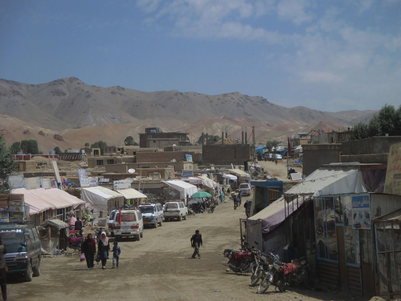
    Zimą na ulicach Lhasy 90 procent ludzi to Tybetańczycy. Dla wielu jest to pierwsza wizyta w stolicy. Często to dla nich jedyna okazja zobaczenia na własne oczy obcokrajowców, więc liczne prośby o zdjęcia z turystami są na porządku dziennym. Setki ludzi wykonuje wokół Potali tzw korę, czyli okrążanie pałacu przy okazji nieustannie powtarzając najsłynniejszą tybetanskia mantrę “Om mani padme hum” i kręcąc młynkami symbolizującymi modlitwy. Inne miejsce kory to historyczne centrym miasta, w środku którego znajduje się świątynia Dżokhang ze statuą Buddy Siakjamuniego, która według legendy została poświęcona przez niego samego.
    Wzgórza na obrzeżach miast pokryte są niezliczonymi kolorowymi flagami modlitewnymi, które zawieszają pielgrzymi. Powiewające na wietrze mają nieść prośby do bogów.
Ponieważ Tybet dzieli się na siedem regionów, każdy z nich wyróżnia się innym strojem oraz językiem. Bywa, że Tybetańczycy z różnych stron są zmuszeni porozumiewać się w języku      Mandaryńskim, ponieważ lokalne dialekty są dla nich niezrozumiałe.
    O każdej porze dnia w licznych kawiarniach i restauracjach zbierają się ludzie, przeważnie mężczyźni, aby grać w karty lub lokalne gry planszowe. Popijają przy tym tybetańską herbatę – słodką, robioną na mleku z cukrem, lub słoną z dodatkiem masła z mleka z jaka, będącego tu jednym z głównych zwierząt hodowlanych. Pomimo, że obecnie w Lasie można zjeść hamburgera w KFC, lokalni mieszkańcy preferują tradycyjne tybetańskie potrawy takie jak tsampa – mieszankę prażonej jęczmiennej mąki z maślaną lub słodką herbatą, różnorodne wypiekane chleby oraz sery i jogurty z jaczego mleka.
    Zbliżając się do południa Tybetu, gdzie po raz pierwszy możemy z daleka dostrzec Mount Everest, dosłownie brakuje tchu. O ile dla niektórych 3600 m n.p.m w Lasie nie stanowi probemu, tutaj wysokość zdecydowanie daje się we znaki. Przekraczamy przełęcze położone powyżej 5200 m n.p.m, gdzie nawet zwykły szybszy marsz może przyprawić o zawroty głowy. To miejsce trudne do życia zarówno dla ludzi, zwierząt jak i roślin. Brak zalesienia stoków gór dodaje im potęgi i niedostępności. Ogołocone skały pokryte na szczytach śniegiem i lodem to marzenie wielu himalaistów. Do 1950 roku Nepalskie władze zakazywały obcokrajowcom wstępu do ich kraju, przez co wszystkie ekspedycje na Mount Everest (począwszy od 1921 roku) prowadziły przez Tybet. W tymże roku to Chiny zamknęły swoje granice, a Nepal zezwolił na zagraniczne wyprawy. Pierwsze zdobycie szczytu w 1953 nastąpiło więc właśnie z nepalskiej strony.

    Z najwyższego na świecie monasteru Rongbuk (4980 m n.p.m.) rozpościera się niesamowity, niczym niezasłonięty widok na Chomolungmę. To właśnie tu powstają jedne z najpiękniejszych zdjęć tej góry. W drodze powrotnej do stolicy zatrzymujemy się jeszcze aby podziwiać Lodowiec Kharola, przy którym zbierają się również tybetańskie wycieczki. Wszyscy są zawsze chętni i ciekawi rozmów z obcokrajowcami. Panuje powszechna opinia, że Tybetańczycy bardzo lubią turystów z zachodu i cieszą się z ich odwiedzin. Pytają o to, jak postrzegany jest Tybet w innych krajach. Zawsze zachwalają też przyrodę swojej ziemi, gościnność i uczynność swoich ludzi.
    Bez wątpienia Tybetańczycy to jeden z najbardziej przyjazych (choć nierzadko awanturniczych) narodów, o fascynującej historii i kulturze, która pomimo licznych opresji przetrwała do dziś. Choć od “odkrycia” Tybetu minęło już wiele dziesięcioleci, ta kraina wciąż zachwyca i czaruje. Zobaczyć Dach Świata na własne oczy, spróbować herbaty z jaczym mlekiem i pozdrawiać wszystkich tybetańskim “Tashi Delek” to jedyne w swoim rodzaju doświadczenie, przygoda pamiętana do końca życia.


Tuesday 24 September 2019

7 days in Tibet.


    Tibet has always been a mysterious land for people from both West and East. Europeans were intrigued by the culture and life in this inhospitable and difficult terrain. Asian wished to conquer the region which was a buffer zone?? Between China and India. For many years Tibetan army as well as natural predispositions.
Successfully defended the access to their homeland. What’s more, it was actually Tibetans who would annex neighbouring lands to create an empire with its northern borders in present day China and southern in present day Bangladesh. Lack of written documents leaves a blank spot on this period of Tibetan history and we can only imagine how the life on the Roof of the World was back then. 
    In 7th century Tibetans decided to sign a treaty with China to defend themselves from the mutual enemy. To seal it, Tibetan leader married a daughter of Chinese emperor. She’s the one who is believed to bring Buddhist religion to Tibet. The religion which will later dominate over original Tibetan Bon believes. A few centuries later the nation transformed from aggressive to peaceful one, supported by contacts with Mongol Empire. Hence even today there are many similarities between the two nations. It’s a Mongolian word Dalai which became the title of the highest religious leader of Buddhists (Dalai means “ocean”; as an unfinished knowledge) – Dalai Lama.
    Since the beginning of 20th century Tibet was practically unknown to Europeans. The first of them to arrive where missionaries and then British delegates being East India Company (present day India) representatives. The first conflict has started in 1903 when British delegates accused Tibetans of Cooperation with Russian Empire, which was a British enemy. Various treaties between the parties eventually guaranteed peace and made Russians and British accept Chinese control over Tibet.    
Even though Tibetan independence was not internationally recognized, after the end of the last Chinese dynasty (Qing, in 1913), the land became independent. Tibetan government has even started to issue its own postal stamps. 
    Social life of Tibetans in that period could be quite controversial for a modern reader. The cast system – popular as well in India, was common. It determined life of an individual, his career and life opportunities. Many people lived in villages often resembling the ones from the Middle Ages. Food was scarce, housing was very primitive, lack of hygiene and health care caused high mortality rate. At the same time the ones who resided in the Dalai Lama’s palace had all the modern facilities and commodities.    

    It was all changed when Chinese People’s Republic was established on October 1 1949. The political leader Mao Zedong, and his advisers tried their best to turn China into a role model communist country. Any cultural or ethnic diversity wasn’t welcomed. In 1950 Chinese Liberation Army arrived to Tibetan Plateau under the propaganda of liberation from imperialistic/western domination. Until the end of 1950’ the leaders in Lhasa – Tibet’s capital were guaranteed autonomy, but in 1959 the rising tensions between locals and Chinese forced the Tibetan leader – Dalai Lama to escape from his homeland and create the government in exile in an Indian town of Daramshala.
The dispute if annexing Tibet to Chinese territory was a right decision is still going on. On the one hand it has limited Tibetan people’s independence and rights, suppressed their culture and religion and caused uncountable amount of historical relicts to perish. On the other hand, we cannot ignore the fact that Chinese people’s activities in the Tibetan territory has highly improved lives of a regular citizens of the region. The cast system was abolished, education became compulsory (prior to that the majority of people were illiterate), the hygiene and sanitation have improved (the infant mortality rate decreased from 45% in 1959 to 0.3% in 2019).
    Along with the new Chinese policies to open up to the outside world in the end of 1970’, Tibet became a place of interest for many travelers and mountain climbers. The famous book by Heinrich Harrer “Seven years in Tibet” and the film with the same title became the spark for many people to visit the land shown in the book as a romantic and mesmerizing place, with intriguing People and breath taking views. Colourful clothes, traditional infrastructure, mysterious rituals and magnificent Himalaya Mountains. All of this made Tibet a place to be in that period of time.  

    Unrestricted travelling in the region was suddenly stopped. Constantly rising political tension and more and more protests of desperate Tibetan independence and freedom fighters caused strict limitation on visiting the region by foreign travelers. Ever since 2008 Tibetan Autonomous Region (created in 1965) became a restricted part of China not only for outsiders but for Tibetans living in other provinces of China, too. 
    Ever since for all those who don’t have Chinese ID the only way to visit Tibet is to sign up for an organized tour where you will be accompanied by a guide and a driver. A single person can go too, however usually a few people go together to share the costs, which are not from the lower shelf. Searching for Tibet trip you can find practically every possible option and flexible itineraries. From a weekend runaway, to a few week long journeys. Sightseeing Tibet’s capital - Lhasa in a few days or a road trip to a little less beaten tracks and the option to see the world’s highest mountain – Mount Everest (called here Qomolangma), which peak is divided between Nepal and China.
    For independent travelers this kind of trip might seems boring but even in these limited circumstances you can make the journey a little bit different than the typical one. The key is to not go “off the beaten track” but rather “off the beaten time” (avoid summer – the high season). Tibet in winter is a totally different place than the one which is seen by the crowds of tourists who come there in summer. 
    Travel agencies’ photos promoting The Roof of the World, films showing its beauty, books’ descriptions and romantic visions of the mystic land is definitely not the place which a person who goes there is summer will see. Traffic jams, the need to book every restaurant limited time for entering some places of interest, lining up to take photos, common cloudy weather. It’s just a part of reality in the high season time. Even Tibetan people are hard to be spotted (except for those who are engaged in different forms of tourism). The normal view is a mass of western and Chinese tourists in almost every part of TAR (Tibetan Autonomous Region).

    On the other hand winter is the time which scares off the majority of tourists, who are afraid of unbearable temperatures. The truth is that the average elevation of 4000 meters above the sea level may suggest very low temperatures, but it’s still a far cry from a Siberian winters. The big snow can be practically only seen on the highest mountain peaks. Regular winter clothes are enough to be out during the day and nights are normally spent in warm hotels (international tourists/travellers are accommodated in the high standard hotels). Tourism as well as infrastructure are very developed. It doesn’t surprise then that to the Tibetan Everest Base Camp one can get by the paved road. 
    Occasional winter breeze helps to move away the clouds from the perfectly blue sky and sweep off the snow from the mountain peaks. That guarantees breath taking views on the Himalayas. All the most famous peaks such as Lhotse, Makalu or Cho Oyu are perfectly visible. Even our tour guide was surprised by the weather, during out 7 day trip, which is quite uncommon in the summer season. 
    Forced to join the group, I was trying to find the least commercial agency, which at the same time offers the same program. Eventually I was a part of 3 people group (me included), compared to summer time groups of dozen or more people. Less companions allows more flexibility, more time for sightseeing. One thing doesn’t change despite the size of the group – in Tibet you don’t ask about politics. Such conversations may end up very unpleasantly. You never know who of the people you see or meet on the streets collaborates with the Communist Party and spies on outsiders. 
    The tour itinerary is not very tight. There is no rush to visit 2-3 attractions in Lhasa chosen for each day in the city. After 3 days spent there we hit the road and go to other cities and towns of Tibet. Most of the visited attractions are Buddhist temples and monasteries; original as well as those reconstructed after the Cultural Revolution (1966 – 1976) during which more than 6000 sacred buildings from the Tibetan region were destroyed. In the present day Tibetans under certain conditions (for example: they cannot possess or publish Dalai Lama’s portrait) can openly practice Buddhism. 
    Because most of the people living in TAR are farmers, winter is the only time when they can make a pilgrimage to the most sacred places in their land – the city of Lahasa and Mount Kailash. Pilgrimaged often last for years as the people move by constant prostrations.
Common view in the whole Tibetan territory are Buddhist monks wearing dark red clothes, studying religious scripts, making rituals or wandering around city with a smartphone in their hand. The clash of two cultures in an inevitable part of globalization and a sign of quickly changing life.
    For the western guest Tibet is mostly colourful, soaked with incense smells and butter lamps temples, where various rituals take place. Often even Tibetans don’t fully understand its meaning. Every part and element of the temple has its meaning and role. The walls are covered with hundreds of detailed paintings. The visitors of the temples ask for health, happiness and love, but also for the world peace. Small offerings in the temples help to “boost up” your Karma – deeds which decide about your reincarnation – being reborn in a new body (human or animal, depending on the current life deeds).

    In winter 90% of the people in Lhasa are Tibetans. For many it’s the first trip to their capital and the first and only chance to see foreigners, hence locals asking for selfies with tourists are quite common there. Hundreds of people do “kora” – circumambulating around the Potala Palace accompanied by constant repetition of famous mantra – “Om mani padme hum” and turning the prayer wheels. The other place to do kora is the historical city center with Jorkang Temple located in its middle. According to the legend the Buddha statue inside the temple was blessed by the Buddha himself. The only of its kind in the world.     
    The hills surrounding the Tibetan cities are covered with colourful prayer flags, installed there by pilgrims. They are believed to be passing the messages to the gods.
Tibet is divided into seven regions. Each of them has different national clothes and language/dialect. It’s common that Tibetans from different parts of the country need to use Mandarin language (which is not taught in schools from the early stage) to communicate with each other.
    Any time of the day, in the numerous tea houses and restaurants people, usually men, gather to play card games or local board games. They drink Tibetan tea – sweet, made of milk with sugar, or salty – with yak’s butter, the animal which is the most commonly kept as farm animals in Tibet. Even though in the present day Lhasa you can eat a burger in KFC, locals prefer traditional Tibetan meals such as tsampa – roasted barley flour mixed with sweet or salty tea, various types of bread or cheese and yoghurts made of yak’s milk.  
    Coming closer to the southern Tibet, when for the first time we can catch the glimpse of Mount Everest, we are left literally breathless. 3600 meters above the sea level in Lhasa may not be such a problem for a lot of people, but here the altitude hits. We cross passes located over 5200 meters, where even a slightly faster walk causes dizziness (because of the lack of oxygen). This is an inhospitable place for all, people, flora and fauna. Snowy mountain peaks are dreams of many climbers. Until 1950 Nepali government forbid foreigners to enter their country, hence all the climbing expeditions to Mount Everest (starting from 1921) would be led through Tibet (through so called North Face). In 1950 it was China who closed its borders and Nepal opened them. So the first man on the top of Mount Everest got there through Nepali South Face of the mountain.

    From the world highest monastery Rongbuk (4980 meters above the sea level) there is undisturbed view over Qomolangma. It is the place where most of the famous and breath taking photos of the mountain are taken. On the way back to Lhasa we stop near Kharola Glacier which also attracts Tibetan tourists. Everyone is always eager to chat with foreigners. Tibetans are believed to be fond of foreigners and are happy when they see them on the Roof of the World. Locals ask about opinion of Tibet abroad. They always praise Tibetan nature, hospitality and friendliness of the local people.  
    Unquestionably Tibetan people are one of the friendliest (however, having spitfire attitude is not uncommon) nations of the world, with a fascinating history and culture. Despite many problems and conflicts their culture survived till this day. Even though many years have passed since the “discovery” of Tibet, the land still mesmerizes and overwhelms. To see the Roof of the World with your own eyes, try yak’s milk tea and greet everyone with Tibetan “Tashi Delek” is an experience one of a kind, an adventure for a lifetime.    


Tuesday 17 September 2019

the tragedy of the aral sea. | polish & english essay

Small break from Afghanistan posts. I've decided to publish my old essays which didn't make it to be published in paper print. Feeling the need to share them somewhere, I'll post them here. Originally written in Polish language, I have also provided a (not sooo good) translation. The first one is about dying Aral Sea. (Kazakhstan visited in 2017, Uzbekistan in 2018)


    After one and a half days of crossing the desert of western Kazakhstan in a ride hitched in a truck, GPS finally shows that my destination is just a few kilometers away. Soon after that I am getting off near a small road leading to Aralsk – a town located on the banks of an Aralsk Sea (though it’s technically a lake). Even though the golden age of this place is long gone and these days the city has many problems, it is still a home for thousands of people. The most important is missing though – the lake is long gone…

    Two different countries, two different cultures, one problem – called the biggest ecologic disaster in history – drying out of the Aral Sea. Kazakhstan and Uzbekistan share the access to the formerly 4th biggest lake in the world. It’s located at the border of both countries. Highly developed fishing industry guaranteed income and many job opportunities for locals – over 80% of the citizens of the region were employed in fishery. Two main cities – Aralsk in Kazakhstan and Muynak in Uzbekistan were prosperous centers of fish production.
    Everything changed in 1960’ when Soviet Government got an idea which turned out to be the beginning of the end of Aral Sea and a tragedy of people which has its consequences until today. The desert area around the lake was decided to be transformed into a cotton field – the main exported product of USSR. The two rivers which ended in the lake were relocated so that the water would go into the desert. Unfortunately, unprofessionally made irrigation canals would lose up to 70% of the water which evaporated instead of getting to its destination. The lake rapidly losing its source of water started to change.
    Eventually Soviet plan succeeded and in 1988 Uzbekistan become the world leader in cotton production, however the price to be paid for this achievement was too high. The lake was rapidly drying out. Still, until 1990’ nobody seemed to be interested in the disaster. What’s more, Soviet scientists from the very beginning of the “cotton plan” could foresee its consequences, but no one dared to question the decisions given by the ones in charge. Only after the had USSR collapsed, five countries (Uzbekistan, Kazakhstan, Tajikistan, Turkmenistan and Kyrgyzstan) took the responsibility to protect the lake. The water restoration program was started and now the levels of the water rise slowly year by year.  
     Pumping new water into the lake will not change the serious ecological and climate changes which occurred in the Aral region. Rapid decreasing of water level caused increasing of salt in the lake (from 10 grams per liter to 100 grams per liter). Because of that fish in the Aral Sea perished. In 1960’ more than 43 tons of fish were caught. 20 years later the number dropped to zero. Both Kazakh and Uzbek region surrounding the lake have serious sand storm problem. The wind brings not only dust and sand but also particles of salt and toxic elements – the remnants of Soviet biological weapon tests.    
     On one of the islands of Aral Sea - Rebirth Island – in 1950’ a base to store anthrax and other dangerous bacteria was build. After abandoning the laboratory in 1991 many containers were not disposed. Until today the bacteria from the old and unsealed containers can spread around the living areas, such as Aralsk and Muynak. Many illnesses affecting digestive system, cardiovascular system, kidneys, anemia and high infant mortality are common among the citizens. The climate has been affected as well. 50 years after the beginning of the drying out of the lake process, the number of days when the temperature exceeds 40 degrees doubled. Summers become hotter and winters colder. The soil contaminated by salt is useless for cultivation crops except for a few die hard ones which can only be used as a food for farm animals. The dry area which was formerly a part of the Aral Sea is so big that it was named Aralkum Desert.           
     Present day Aralsk is a small town with dusty streets and abandoned port with rusty cranes and falling buildings. All fisherman boats are gone except for two restored ones which are located in the towns green square from which one can have a view of the former lake bank. There’s also a museum. It shows Aralsk in its best times. Many photos show prosperity of the town before the lake dried out. Huge jars filled with formalin present fishes famous in the region.

    Every day on the main town’s square shopkeepers and taxi drivers gather and wait for people travelling to neighbouring villages. Once in a while a western tourist, who wants to see the (in)famous fisher boats cemetery, is one of their passengers. Local people can’t quite understand why somebody is willing to drive thousands of kilometers only to see an old rusty boat. For them its only use is to sell it as metal scraps. The last fisherman boat from Aralsk ended up this way a few years ago.
     To see the last of rusty fisherman boats of Aral Sea I have to go on the other side of the lake – to Uzbek city of Muynak, former prosperous fisher town. Similarly to Kazakhstan I’m hitting the desert highway and after hundreds of kilometers I’m reaching Nukus – the biggest city in the region. From there one can catch a bus (usually delayed and overcrowded) to Muynak. Recently more and more common sight are tourist jeeps and vans also heading that way.
  Presence of foreigners in this unusual place does not seem to surprise the locals. The new Uzbek president has changed the visa application process and since July 2018 getting E-visa is a matter of an online application and a few days of waiting. Thanks to that, more “dark tourists” come to visit Muynak. The remaining boats were put in a line and a special platform was constructed to see them from the above. It’s also possible to hop into one of the rusty boats using newly installed stairs. Local museum and a photo session with fishing boats are probably the only “attractions” in Muynak. 
    The rest is the real, daily life in the city. Unemployed people, who lost their jobs after the last fish factory closed, people complaining about worsening health and politicians ignoring this part of the country, youngsters trying to leave this place and look for a better life elsewhere, empty restaurants and coffee shops. There are also those who despite all the problems and obstacles don’t want to leave their homeland. Maybe they still hope that one day the lake will again be a source of jobs and the sense of their lives. 
     Who decided to visit these “ghost” towns is definitely not a regular tourist. These places are not beautiful or relaxing. They are gloomy, depressing and disturbing. Aralsk and Muynak along with loads of similar places of disasters and tragedies year by year become more popular destinations for previously mentioned “dark tourists”. The ethics of treating those places as a visiting zones is questionable.
     Of course the Aral Sea is not the only “attraction” to be visited (if at all) in Kazakhstan and Uzbekistan. Both countries are full of beautiful and interesting places, both natural and historical. It’s still not very popular and undiscovered region of the world, without masses of tourists seeing the views through their cameras’ lenses. Here, still, hospitality and friendliness are the essentials of the culture, thanks to which you can feel at home.    


    Po półtora dnia jazdy po bezkresach zachodniego Kazachstanu zatrzymaną na stopa ciężarówką, GPS pokazuje wreszcie, że do celu mojej podróży pozostaje kilka kilometrów. Niedługo później wysiadam przy niewielkiej drodze wiadącej do miasteczka Aralsk – położonego nad Jeziorem (zwanym także morzem) Aralskim. Pomimo, że dni świetności miasta już dawno minęły, a dziś boryka się ono z wieloma problemami, wciąż jest ono domem dla kilkudziesięciu tysięcy osób. Brakuje jednak najwaznejszego – jezioro od kilkudziesięciu lat w tym miejscu przestało istniec… 
    Dwa różne kraje, dwie odrębne kultury, jeden problem - okrzyknięta największą katastrofą ekologiczną w dziejach – wysychanie Jeziora Aralskiego. Kazachstan i Uzbekistan dzielą się dostępem do niegdyś czwartego co do wielkości jeziora na świecie, które znajduje się na granicy obu krajów. Rozwinięty przemysł i przetwórstwo rybne zagwarantowały obu miejscom znaczne dochody i liczne miejsca pracy - ponad 80% mieszkańców regionu trudniło się rybołówstwem. Dwa kluczowe miasta – kazachski Aralsk i uzbecki – Muynak były prężnymi ośrodkami produkcji konserw oraz innych przetworów rybnych. 
    Trwało to do lat 60tych, kiedy to sowiecki rząd wpadł na pomysł, który okazał się początkiem końca jeziora oraz tragedii ludzi i środowiska, która trwa do dziś. Niewykorzystany pustynny teren wokół zbiornika wodnego postanowiono zmienc na tereny uprawy, przede wszystkim bawełny, która miała stać się głównym produktem eksportowym ZSRR. Dwie zasilające jezioro rzeki zostały przekierowane na pustynię w celu jej nawodnienia. Nieumiejętnie zbudowane kanały irygacyjne traciły aż do 70% wody, która wyparowywała nigdy nie docierając do celu. Tym samym jezioro straciło dopływ świeżej wody, przez co jego charakterystyka zaczęła się gwałtownie zmieniać. 
     Ostatecznie plan sowietów się powiódł i w 1988 Uzbekistan stał się liderem w światowej produkcji bawełny, jednak rezultaty tego przedsięwzięcia były już nieodwracalne. Jezioro wysychało w zawrotnym tempie. Pomimo tego, aż do lat 90tych nikt nie zdawał się być zainteresowany katastrofą. Co więcej, sowieccy naukowcy już od początku planu przewidywali jego kosekwencje, jednak nikt nie śmiał sprzeciwić się decyzjom “z gory”. Po upadku ZSRR pięć krajów (Uzbekistan, Kazachstan, Tadżykistan, Turkmenistan i Kirgyzstan) podjęło się odpowiedzialności za ratowanie jeziora. Rozpoczęto realizację programu, mającego na celu zwiększenie ilości wody, której obecnie faktycznie z roku na rok przybywa. 
    Jednak przywrócenie części wody nie zmieni tak szybko poważnych zmian klimatycznych, które zaszły w regionie. Gwałtowny spadek poziomu wody spowodował wzrost zasolenia jeziora, które wzrosło z 10 gramów na litr do ok 100 gramów na litr. Ta drastyczna zmiana uniemożliwiła hodowlę i połów ryb. W latach 60tych połów obliczano na ponad 43 tysiące ton rocznie, a 20 lat później przemysł rybny przestał całkowicie istnieć. Zarówno kazachski jak i uzbecki region wokół jeziora zmaga się dziś z problemem burz piaskowych, które niosą że sobą nie tylko pył i piach, ale także drobiny soli wyparowanej z wody oraz tokstyczne elementy – pozostałości po prowadzonych sowieckich testów broni biologicznej. 
    Na wyspie zwanej Wyspą Odrodzenia w latach 50tych skonstruowano bazę, w której hodowano i przechowywano m.in wągilka oraz inne groźne bakterie. Po opuszczeniu laboratorium w 1991 roku wiele pojemników nie zostało zutylizowanych. Do dziś bakterie z rozszczelnionych zbiorników mogą rozprzestrzenić się na okoliczne zamieszkałe tereny, między innymi Aralska oraz Muynak. Faktem jest, że wśród mieszkańców regionu szerzą się różnego rodzaju choroby nerek, układu pokarmowego, krwionośnego, anemia oraz wysoką śmiertelność wśród noworodków. Ponad 50 lat od początku procesu wysychania jeziora liczba dni, w których temperatura przekroczyła 40 st C zwiększyła się dwukrotnie. Lata stały się gorętsze, zimy bardziej srogie. Obecność znacznej ilości soli w glebie uniemożliwia uprawę roślin z wyjątkiem tych najbardziej odpornych, które mogą zostać przetworzone na paszę dla zwierząt. Wyschnięte dno jeziora zajmuje tak dużą powierzchnię, że teren ten nazwano pustynią Aral-kum.
     Dzisiejszy Aralsk to niewielkie miasteczko z zapiaszczonymi ulicami, opustoszałym portem z rdzewiejącymi dźwigami i rozpadającymi się budynkami. Nawet kutrów już tu nie ma. Wyjatkek stanowią dwa odnowione, znajdujące się w miejskim skwerze, z którego roztacza się widok na dawna zatokę. Jest jeszcze muzeum. Prezentuje ono dawną świetność miasta i jeziora. Na wielu fotografiach można zobaczyć jak dawniej wyglądało życie w Aralsku, jakie przetwory produkowano. W słojach z formaliną wciąż pływają okazy ryb niegdyś zamieszkujących wody akwenu. Codziennie na głównym placu miasta zbierają się handlarze i taksówkarze, rozwożący ludzi po okoliczych wioskach. Co jakiś czas trafi się również zachodni turysta, który podobnie jak ją, chcezobaczyć słynny cmentarz łodzi. Lokalni ludzi nie kryją zdziwienia, słuchając historii obcokrajowców którzy przemierzali setki kilometrów, tylko po to, żeby zobaczyć zardzewiały kuter. Dla nich to tylko złom, na którym można było zarobić – ostatni kuter w Aralsku został pocięty i sprzedany kilka lat temu. 
     W celu zobaczenia kilku prawdopodobnie ostatnich łodzi rybackich Morza Aralskiego należy udać się na przeciwną stronę jeziora, do uzbeckiego miasta Muynak, dawniej rozniez leżącego nad jego brzegami. Podobnie jak w Kazachstanie wiedzie tam autostrada przecinająca pustynię z zaledwie kilkoma miastami po drodze. Z większego z nich o nazwie Nukus dwa razy dziennie kursujelokalny autobus (o ile akurat nie skończy się benzyna, wtedy kurs może być przesunięty o kilka godzin lub całkowicie odwołany). Przeważnie odjeżdżając jest już załadowany po brzegi ludźmi oraz ich pakunkami. Coraz częściej do Muynak jadą też terenowe jeepy i turtystyczne furgonetki. 
    Obecność turystów w tak nietypowym miejscu nie dziwi mieszkańców. Nowy prezydent Uzbekistanu znacznie złagodził precedury wizowe i od lipca 2018 wielu obcokrajowców może uzyskać e-wizę w ciągu zaledwie kilku dni od złożenia aplikacji. Dzięki tym ułatwieniom co roku Muynak odwiedza coraz więcej turystów. W pobliżu kutrów wybudowano nawet specjalną platformęwidokową, z której można oglądać ustawione w rzędzie rdzewiejące łodzie. Na niektórych zamontowano schody, aby zajrzeć do środka. Kilkazdjęć kutrów i wizyta w lokalnym muzeum – to główne “atrakcje” turystyczne Muynak. 
    Pozostaje prawdziwe, codzienne oblicze miasta. Ludzie dawniej trudniący się rybolostwem, obecnie szukający jakiegokolwiek zajęcia, narzekający na zdrowie i polityków. młodzież starająca się za wszelką cenę opuścić to miasto bez perspektyw, puste restauracje i kawiarnie. Są też ci, którzy nie wyjeżdżają, zostają na terenie, od lat należącym do ich rodzin. Być może wciążwierzą, że podnoszący się z roku na rok poziom wody pozwoli na odtworzenie dawnej flory i fauny oraz zmiany w sytuacji ekonomicznej miasta. 
     Kto decyduje się na odwiedzenie tych dawnych portowych miast z pewnością nie jest przeciętnym turystą. To nie miejsca, któreprzyciągają swoim pięknem czy możliwością wypoczynku. To miejsca ponure, o smutnej przeszłości i niepewnej przyszłości, któreskłaniają do refleksji nad życiem i niespodziewanymi zakrętami losu. Aralsk i Muynak oraz wiele innych rozsianych po całymświecie miejsc katastrof i tragedii z roku na rok zyskują coraz większe grono wielbicieli. Amatorów tego typu mocnych wrażeń i interesujących się miejscami różnego rodzaju katastrof i tragedii określa się mianem “dark tourists” (mroczni turyści). 
    Oczywiście Kazachstan i Uzbekistan to nie tylko Morze Aralskie. Oba kraje kryją wiele pięknych i interesujących miejsc, zarówno historycznych jak i przyrodniczych. To wciąż mało popularny i nieodkryty rejon świata, bez tabunu turystów przescigajanych się w robieniu zdjęć, gdzie gościnność i życzliwość wciąż są najważniejszymi elementami kultury. Miejsce, gdzie można poczuć się jak w domu. 

Friday 6 September 2019

Lal wa Sarjangal, Ghor, Afrghanistan

    How I ended up in this Godforsaken place I've already described. But what is Lal-Sarjangal like? 
Most of the locals I asked about Lal, didn't know where it was or what it was like. When they heard "Ghor" (the province name where Lal is located), fear takes over as the place is considered having "security problems" (means it's fuck*ing dangerous coz of the Taliban). It's true to a certain point as big chunks of the province are indeed controlled by the bearded guys. 


    But not Lal. Being entirely populated by Hazara ethnic group it has no local disputes with other minorities nor Taliban are supported here, (as they are Pashtuns) hence no terrorist activity. 
    Lal is located 5 hours by car/van from Bamyan, and around 10-12 hours from Kabul. Alternatively one can fly from Kabul to Bamyan (30 min) and then continue by road. The Kabul-Bamyan section is a problem; one of the roads through the province of Wardak is controlled by Taliban and they regularly check passengers and look for high rank officials etc. The other-longer way through Parwan is much better but still it's not 100% safe. From Bamyan on the way is normal and people travel even by night.    


    Before coming to Lal I didn't know what was it like. I kind of expected some small town, a bit smaller then Bamyan, which I'd visited earlier that same day. Leaving Bamyan I noticed the absence of electricity lines so I started to create the image of Lal. We arrived at night and I couldn't see much but I've spotted some light bulbs so decided it wasn't that bad. I spotted mud houses and in the same kind of house I stayed that night and for the following 4 weeks. 
    The light of the next day have me a perfect view of the Lal bazaar, school and surrounding villages. Mud houses, solar panels to provide electricity, water in the wells, rare TVs and almost non-existent Internet. Not my first time in a place like that, but definitely the first one I'd stay for a longer time in and the call (yet another) home :)
    I was actually somewhat surprised with myself how smoothly I made a transition from a modern-have-it-all city in China to this remote and backward village in Afghanistan. I loved it at the first sight. Private bed, hot showers and constant availability of any goods were over. Shared room, cold bucket shower, being constantly surrounded by people who watch your every step. 
    Life in here is all about socializing. People spend hours and hours sitting together (on the floor covered by massive carpet, they eat there, too) in rooms and talking. Visiting friends, family members and neighbours is a daily routine. Needless to say no prior to visit arrangements are needed. 
    I spent my first days staring at the night sky. The type of sky you can only see in deserts or open spaces without artificial light. Cloudless sky reveals all the constellations you can possibly see on the Northern Hemisphere, so visible that it's hard to no want to learn their names.
    
    Lal is surrounded by hills. The village itself is already located quite high on 2800 meter above the sea level so hiking up easily takes you to 3000 m. The altitude already considered high. Since there's not much entertainment in the village I started regular hikes up and down the hills. After a week or so in the village I kind of got used to the altitude so the crazy panting while walking up got reduced to a regular tiredness. 
    In the entire district of Lal-Sarjangal there is not a single fridge. The nearest ice cream or ice coke is 5 h away in Bamyan. The meat has to be stored underground. It's quite expensive in a place where $150 is a lot of money, so meat dishes are not eaten on daily basis. The regular diet consists of rice, beans, potatoes, some vegetables, dried fruit and loads of tea.         Somebody told me that Chinese and Turkish and the biggest consumers of tea in the world but Afghans should be places in the top of the list too. Lamb and chicken are served as well but there're considered a special dishes for guests or on special occasions. 
     
    Same room is used as a dining room and at night as a bedroom. Simple mattresses are places on the floor by the walls and that's it. People often don't even change their clothes for sleeping. Since electricity is not granted people don't really stay up late. 10 pm is a regular sleeping time and 6-7 am a time to wake up. In the houses located farther from the bazaar morning time means baking the bread in a tandoor. 
     Traditional houses are constructed from the mud-like material and wood. Two or more rooms as mentioned above serve as living and bedrooms. The kitchen and storage rooms are located on the sides of the house. In front of the building there is a large yard and a well. All surrounded by high walls with a metal door (for knocking to be heard from inside of the house?).
It's truly a different world. Like you go back in time and see how things were 100 years ago. Donkeys are still used to transport goods, water is carried from wells and clothes are washed in the rivers. Less and less places like this are found in the world. 

Wednesday 4 September 2019

our hearts will go on.


    So people told me there is no alcohol in Afghanistan and drugs are considered very low level. Some locals said that they have never drunk nor smoked in their lives and I have no doubts about it. But let’s be real. We are all people and (not)surprisingly, quite similar to each other in behaviour, despite the location and cultural background.
    So there is this one day, a very special one because it is the first day I’m walking in Kabul totally on my own. Of course others were not happy about this idea but things had to be done and there was nobody available to accompany me (I wasn’t sad about it). So in the end I went to run errands alone.
    That day only I made 4 new friends, visited few coffee shops/restaurants, and bought an Afghan map and a great history book for peanuts. Then the wheel of acquaintances started to roll and soon I was meeting friends of a friend of a friend.
    The next day was even more special as it was 100th anniversary of Afghan Independence. Big celebrations of the streets and my own quite spontaneous one. I was invited to my new friend’s house and headed there without knowing that the party was just about to start. I had a friendly chat with a taxi driver who was patient enough to listen to my miserable Farsi.
    I got picked up by a friend of a friend who happened to speak Russian (I had to refresh mine, not used since summer 2018 and “The Stans Trip”), and thanks to that he become my new friend, too. We were 3 people and a big hookah at the beginning, and then another one joined us, and then a big bottle of vodka and whiskey joined too.
    One remarkable thing happened which can’t be described properly in spoken language if the person was not there, even worse to write the whole thing down. Anyway, it was a hilarious situation and I will always use it as an anecdote from Afghanistan and the only example (so far) of when I got real scared in this country.
    So at some point of the meeting, only 3 of us are sitting in the room. Me and X. are on the sofa discussing a very serious topic on road safety in Afghanistan, meanwhile Z. (who doesn’t speak English well, so he can’t quite grasp the seriousness of the conversation) is sitting next to me (I’m in the middle). From the corner of my eye I see Z. is trying to turn on the TV or something like that. I am telling the story of my road trip to Mazar and the reports on security I’ve heard. I am talking about potential checkpoints installed by Taliban and the second I say the word “Taliban” the massive “boom!” is heard. I freeze, X freezes. I check the back of my head if it’s still there and then look forward only to see the big TV with a music channel on, a band playing Afghan instruments, including the drum. In a few seconds I understand what has just happened. Z. finally turned the TV on, which happened to be set on a VERY high volume (the sound system in the room was pretty good), and the channel he turned on was the music one. Only by a cruel coincidence or a perversity of inanimate objects this all happened at the same time; me saying “Taliban” and Z. switching the channels to the drum playing guy. After few seconds we were all laughing out loud and the story was kept being repeated throughout the evening which was just about to start.
    I found out that Z. was working in a anti-drug department, so the greater my surprise was when he was the one to bring hash to the room and add it to the hookah. Hashish is quite popular in Afghanistan, and after that night I saw people smoking it on the streets in a day light (I was even offered to smoke once). It’s definitely not something you have to hide from the others.
After a few more drinks the forever young song “My Heart Will Go On” from “Titanic” was played. As it wasn’t my first time hearing the song in Afghanistan, I was curious why people choose this particular one to be played during drinking sessions (not exactly the party type of song). Y. who has already come back and speeded up his drinking pace to catch up with us explained, that “Titanic” came to Afghanistan during the Taliban regime and as music and films were all forbidden, it was quite a challenge to watch it. Kids and teenagers would gather at nights to watch it, under blankets or with windows covered by curtain so that nobody could see the screen light from the outside. The film as well as the song bring back the memories of childhood, hence the song popularity among Millennial in the country.
    The party went on for the next few hours; dozens of topics were discussed (no idea which ones, though), loads of laughter and one of the first encounters with “a very normal life” in Afghanistan. Suddenly the cultural correctness, background differences and religions stopped being important. We were just a bunch of young(ish) people having a house party. Something so regular to loads of people and something so unusual to others.
    Afghanistan keeps surprising me. So far, only and always in a positive way. And each time I love the country even more and even more I want to tell others how amazing and normal, surprising and very regular this place is.   

Sunday 1 September 2019

the ghan.


     I have a thing for trains. I'm a kind of trainspotter without actually taking account of the trains; looking at them is enough for me. I've done my share of train trips in Poland and even bigger one in India, where I realized being more than 30 hours on the train is no fun (as to verify the romantic concept of the Transsiberian 7-day long journey). Still, trains have always been there in my life and one of my favourite places in cities are train stations.


    Years back, in Australia I happened to "discover" The Ghan - transcontinental train connecting two edges of the country, being the second longest train trip in the world (54 hours and nearly 3000 km). I visited the train station in Alice Springs where The Ghan stops for 4 hours and peered inside the compartments. Classical looking as being taken from the beginning of 20th century.
    Now, why the "Ghan"? The original name was "The Afghan Express" and one of the stories says that when British colonizers failed to reach Australia's extremely hot interior, they hired Afghan camel drivers to complete the task. They build the rail tracks and afterwards let the camels go free (it might as well be that camels somehow escaped), hence nowadays Australia has a big population of wild camels.
    The alternative story says that "The Ghan" was rather a mocking name given by the Europeans to indicate questionable reliability of the train service.
    Either way, it has something to do with Afghanistan and funny enough not many people in here know about the story (personally I haven't met anyone yet). So the greatest was my surprise when I saw the painting on one of Kabul's infamous defense walls.
    So it's not an unknown story. It's a story to be spread as yet another positive feature of this mysterious and undiscovered country.